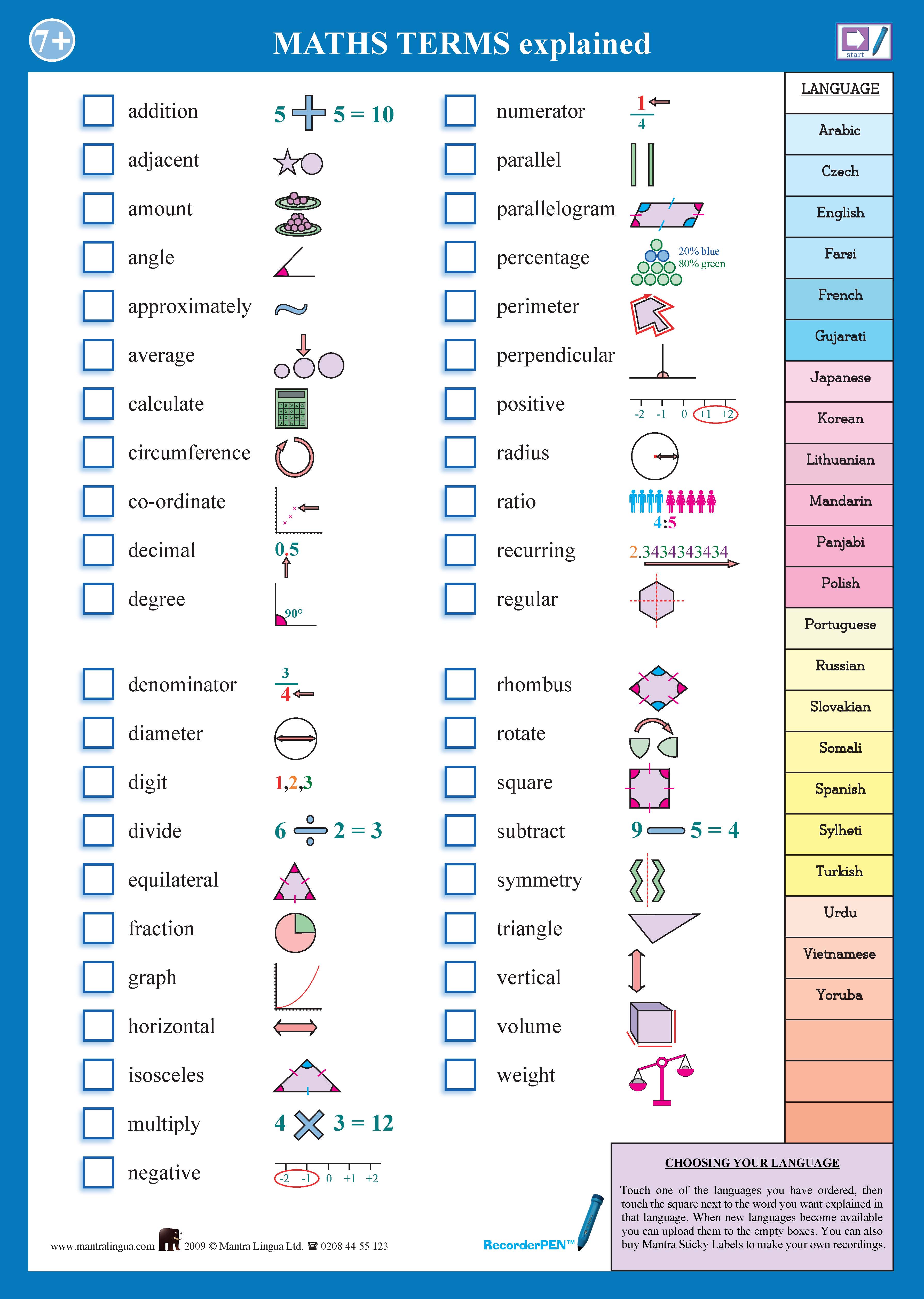
Shortlisted for the NASEN award for ICT Inclusivity, this multilingual resource provides over 8 hours of definitions, explanations and examples of key terms taken from the Maths National Curriculum for Key Stages 3 and 4. As useful for native English speakers as it is for EAL students, the "Key Terms" series helps students quickly assimilate key concepts and terms.
The terms are: Addition, adjacent, command, angle, approximately, average, calculate, circumference, coordinate, decimal, degree, denominator, diameter, digit, divide, equilateral, fraction, graph, horizontal, Isosceles, multiply, negative, numerous, parallel, parallelogram, percentage, peremeter, perpendicular, positive, radius, ratio, recurring, regular, rhombus, rotate, square, subtract, symmetry, Triangle, vertical, volume, weight
These resources are particularly useful for new arrivals, allowing students to access key terms in their native language. With this PENpal enabled poster, teachers can quickly assess new students: simply select a language from the following Arabic, Czech, English, Farsi, French, Lithuanian, Mandarin, Panjabi, Polish, Portuguese, Russsian, Slovakian, Somali, Spanish, Sylheti, Turkish, Urdu or Yoruba and then touch the pen to the words that you would like to hear explained.
NB You need a PENpal or RecorderPEN to hear the audio content of this chart.
For more "Key Terms" posters, take a look at our Key Terms in Science, Geography and English.

